
Our complex twin tropical cyclone forecast is becoming a little less murky, and unfortunately, the US landfall probabilities are increasing. #94L is currently sitting over Hispaniola, and the topography of the island should help it generate vorticity. As the system...(1/4)

...continues to slowly lift north of the Antilles, it will encounter a rather favorable and divergent upper pattern. This pattern will evolve into a proper ULAC as #94L traverses the Bahamas, and we'll likely intensify over these warm SSTs. #Humberto should be a strong...(2/4)

...hurricane tracking WNW at this time. By day 3, our upper trough will be encroaching on the Southeast US. The dry air associated with it will start wrapping towards #94L and southerly shear will increase. How strong the system has managed to get before this point will...(3/4)

...determine how resilient the storm will be to these conditions. Unfortunately, the cut-off and negatively tilted nature of this upper trough looks to provide a steering mechanism that could bring #94L into the Southeast US around day 5. We will see if this persists. (4/4)
@DCAreaWx This system needs to be watched!
This year one of the experimental HAFS configurations our group is running is HAFS-M (M is for multistorm). Rather than a single run per storm, it has multiple moving nests in a large outer domain over the ATL/EPAC. The physics of this configuration are the same as the currently
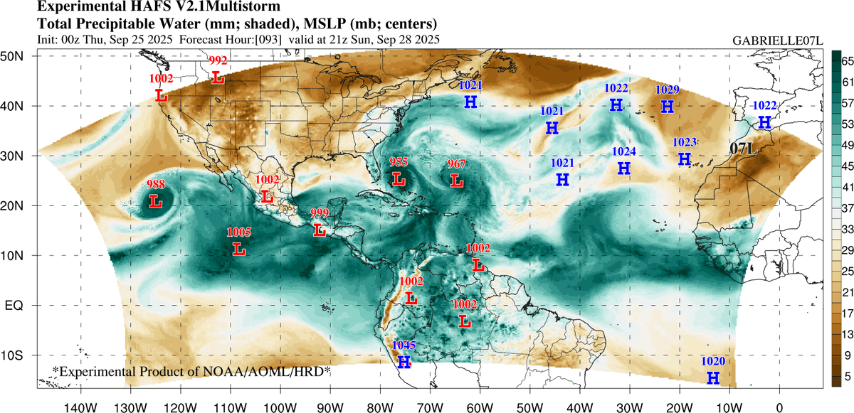

For the first time this #hurricane season, the Atlantic has two named storms simultaneously: #Gabrielle and #Humberto.
Oddly enough, 00z ECMWF, CMC are in perfect alignment for #94L in 5d. Northern South Carolina and North Carolina will have to watch closely. Luckily, with #94L, the environment is not conducive for a strong storm *AT THIS TIME* as there's a ULL over the SE U.S. feeding it dry air
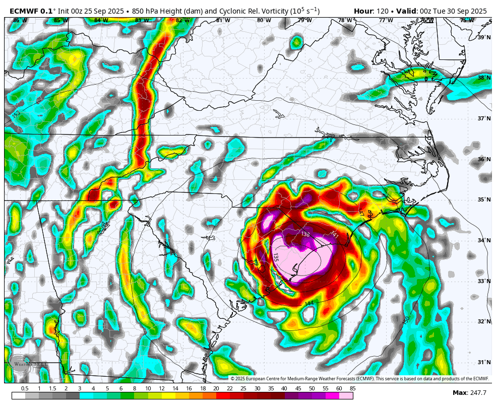

18z Google Deep Mind finally ran and has the Carolinas in its crosshairs for #94L. Meanwhile Humberto is favored to be a major hurricane to its east.
